Since 2016, Rachel has been
involved in a project funded by NERC and DfID investigating the resilience of
rural water supplies in the highlands of Ethiopia, specifically studying the
response to the 2015/16 El Niño drought. As part of this work she recently travelled to Ethiopia to download data
from sensors previously installed to look at how water levels are
changing in sources that people use for drinking water...

The El Niño project in Ethiopia has seen me visit the
highlands of Ethiopia five times in the past couple of years to look at how the
quantity and quality of groundwater is impacted by severe droughts. We were focusing on rural areas, as remote communities are often entirely reliant on groundwater for their drinking
water. People in these parts predominantly use 3 different types of water collection: boreholes (50 – 60m deep),
hand-dug-wells (~5m deep) and springs. We
chose two different districts to investigate the behaviour of these sources, Kobo
and Lay Gaynt. During the 2015/16 El Niño
drought, these areas were both classified by UNICEF as Priority 1, which means
that they were impacted most by a lack of water and food.
Working with our colleagues at Addis Ababa University; Professor Seifu Kebede, Dr Tilahun Azagegn and Yehualaeshet Tayitu, we carried
out groundwater sampling for water quality (including samples for analysis of
major and trace elements, stable isotopes and microbiology) every few months
from the different water source types. To look at water availability after the drought, Andy McKenzie (British Geological Survey) installed
20 pressure transducers, to measure water levels every 15
minutes. As usual with fieldwork, our
most recent visit highlighted some of the pit falls of a relatively new method
of using these loggers – things went wrong, quite a lot!
Sometimes the Kevlar string we used to hang
the loggers on would be horribly tangled, we assume during maintenance, and the
logger would no longer be in the water. Other times the Kevlar would be cut and the loggers missing, a very sad
sight. In total we lost 10 loggers and
had 10 left, not great odds!
 |
| Some of the loggers used |
Despite losing a lot of the loggers, the data we got from
them was really useful and we can start to look at people’s water usage.
One of the most interesting outcomes
is the patterns we see in the shallow borehole water levels (green line). You
can see there is a wavy pattern with short spikes both above and below the main
pattern.
For religious reasons
communities in certain areas don’t use the borehole on weekends; the spikes
below the main line are when the borehole is used more on the Friday to store
water for the weekend and the water level has more time to recover over the
weekend, hence the additional rise on the graph each week.
You can see that the water in the hand-dug-wells
struggles to recover once the rainfall stops, the steep decline in water levels
is linked to a lack of storage in the aquifer and they have little resilience
to periods of drought.
 |
| Water levels from different sources |
During my most recent field visit in March 2019, we handed
out laminated printouts of the water level data that we have been collecting to show the communities what the sensors we were putting down the boreholes were
doing.
It was useful for us to discuss this
with them and also show them where we had seen issues with water quality.
After the start of the main rainy season, microbiological quality of the water rapidly decreases and boiling water can
help avoid people getting sick from bacteria such as e-coli.
 |
| The GPS SPOT tracker |
On a personal level, while away I like to keep in touch with people while I'm in Ethiopia but often my UK phone has no signal, so during my trips I use a GPS SPOT tracker to chart how my journey is progressing. I don’t often get to see these maps when I'm on the ground, as I
never have signal when I’m out there but they're fun to look at on my return!
The SPOT tracker also works really well because my family,
friends and colleagues can all keep an eye out to see where I am while I’m
away.
 |
| Some local Ethiopian food |
And
finally to the food… For most meals, people in Ethiopia eat a fermented
sourdough flatbread called injera. This is made out of teff, Ethiopia’s most
important crop, but one that I hadn’t come across until I first visited in 2016. At first I struggled with the taste as it has
a ‘tang’ to it, but on my last trip I found I was enjoying it more and more. A typical example is in the photos. I am
also now a convert to the very refreshing Mirinda orange drink, and will only
drink Ethiopia coffee. Before I left
from my last trip I also learnt to write my name in Amharic script. I was very
proud of myself and even wrote some it on some of the labels we leave attached
to the loggers!
We’ve
left the loggers installed (where they weren’t lost!) and I’m looking forward
to my next trip back to Ethiopia!
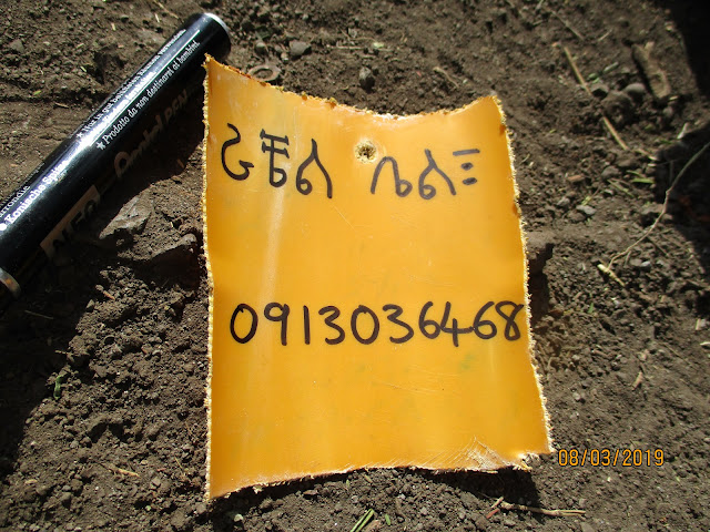 |
| Rachel's name on one of the loggers |
Acknowledgements
The
El Niño project was managed by Professor Alan MacDonald at BGS and been a team
effort of people including; Professor Seifu Kebede, Dr Tilahun Azagegn, Andy
McKenzie, Dan Lapworth and Yehualaeshet Tayitu. Other collaborators include Florence Pichon, Roger Calow and Eva Ludi
from the Overseas Development Institute and Emily Black and Matt Young from
Reading University.


Comments