 |
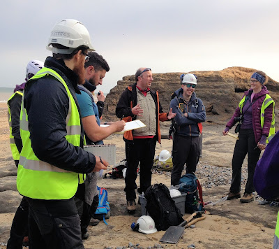
| Dr Jon Lee helping us interpret the geology at Happisburgh, Norfolk |
I've just got back from a new field-based
BGS training course that I enjoyed so much I want to tell you all about it. It's called Quaternary Deposits, Processes and Properties (catchy title) and is designed for geoscientists who undertake geology-based fieldwork or 3D geological modelling who want to gain experience in describing Quaternary deposits.
It was four days in total. The first day was at our headquarters in Keyworth where we were given an introduction to the geology of East Anglia, human evolution in the area and an overview of current coastal management issues. After this followed the nitty gritty of how you describe, interpret and classify Quaternary deposits according to the most recent British Standard.
Then it was off to Sunny Norfolk for the next three days to put all this into practice.
Happisburgh
We started in Happisburgh, a site well known for its coastal erosion and somewhere we have monitored as part of our
Slope Dynamics Project since 2001. The beach here is around 900 metres long and we were tasked with interpreting the entire cliff section to understand what's there and how it got there.
 |
| Starting the cliff section at Happisburgh, "draw what you see...." |
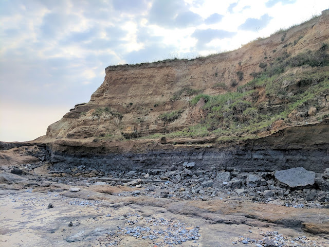
Over half of the bay had geology that looked like this, a nice gentle layer-cake affair:
 |
| The cliff section at Happisburgh. From top to bottom: Happisburgh Sand Member, Ostend Clay, Happisburgh Till |
But then the further south we went, the more complex it became. There was quite a bit of head-scratching, debate and even argument (!) about the palaeoenvironmental conditions (what the environment was like when the sediments were deposited).
 |
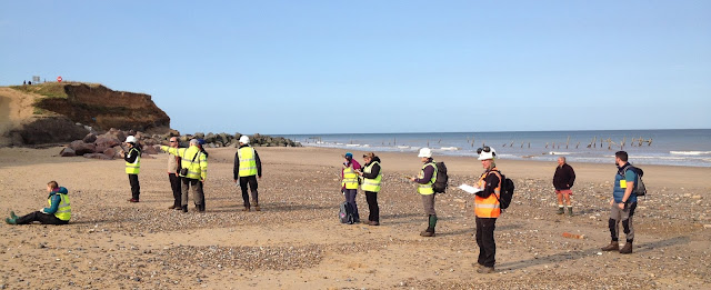
| Getting stuck-in at understanding the geology and Happisburgh |
And then we all drew our different theories in the sand:
 |
| Another sand drawing of the cliffs in front of us. No idea who drew this. It definitely wasn't me. |
 |
| My first attempt to interpret the 900 m cliff section at Happisburgh |
East Runton
The last morning was spent at East Runton where we were again asked to interpret the cliff section. This time, we were more confident and were able to use everything we had learned over the previous two days at Happisburgh. Again there was debate and a lot of drawing in the sand but we came to an agreed interpretation that I would like to tell you all about here but that would spoil it for those going on the course in the future! Instead, here are some pics...
 |
| The cliffs at East Runton, Norfolk |
 |
| Field sketch of the cliffs at East Runton, Norfolk |
So how exactly do you describe, interpret and classify Quaternary deposits?
 |
Dave Entwisle teaching us how to tell the difference
between a silt and a clay by their behaviour |
After drilling or mapping, often the only remaining evidence of what was discovered is the description provided on the borehole log, section or notebook. This can vary enormously depending on who made the description and which classification they were following, if any. High-level decisions can be based ultimately upon these descriptions as, for example, structures are build or tunnels dug. So what might seem like a small part of the work on the day is actually very important to get right.
BS5930 : 2015 is a description of the
behaviour of engineering soils based on material and mass characteristics. An engineering soil is an aggregate of mineral grains that can be separated by gentle agitation in water.
Most Quaternary deposits are engineering soils. BS5930 : 2015 aims to standardise description and terminology to reduce ambiguity and error, no matter who describes them.
Sounds easy right? Well, once we'd got the hang of it, it was actually. It's a systematic examination process where everything is considered in a logical sequence so you are guided through your description from beginning to end. Whilst a more sedimentological description may have been what some of us are more used to, everyone could see the merit of the engineering description.


Comments